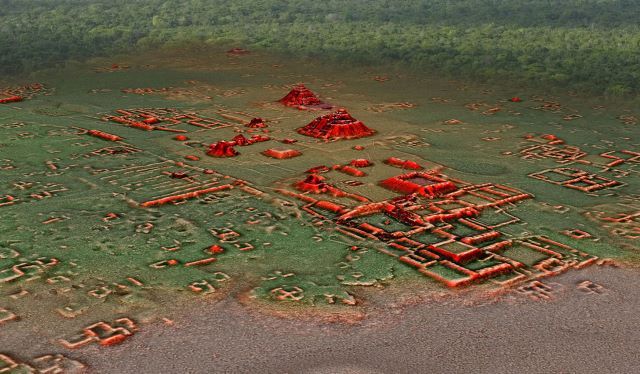
LIDAR Images Reveal Extensive Maya Population Center in Calakmul Biosphere Reserve
It covers more than 200 km2 in the Calakmul Biosphere Reserve. Using LIDAR technology, residential complexes were found grouped around numerous temples, sanctuaries, and possible markets.