Tropical Cyclone Alex could form off the coast of Quintana Roo

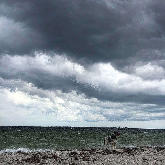
Tropical Cyclone Alex could form off the coast of Quintana Roo in the next few hours. The phenomenon is located on land, in the north of Quintana Roo, 95 kilometers southwest of Cancun.

Tropical Cyclone Alex could form off the coast of Quintana Roo
Another tropical cyclone threat in Mexico. Image by btozeren from Pixabay

The instability zone associated with the remnants of Agatha continues with an 80% probability of cyclonic development in the 48-hour forecast in the Atlantic Ocean. The phenomenon is located on land, in the north of Quintana Roo, 95 kilometers southwest of Cancun; its center is poorly defined and has erratic movement, informed the National Meteorological Service.

The instability zone may become a tropical depression or tropical storm Alex, the first of the season in the Atlantic.

For this Thursday, heavy rains are forecast in regions of Chiapas, Oaxaca, and Quintana Roo, and very heavy rains in areas of Campeche, Tabasco, and Yucatan; as well as strong winds with gusts of 60 to 70 kilometers per hour and waves of two to three meters high on the coasts of Quintana Roo and Yucatan.

Likewise, heavy showers are expected in areas of Chihuahua, Durango, State of Mexico, Guerrero, Puebla, Veracruz and Zacatecas; rain showers in Mexico City, Coahuila, Colima, Hidalgo, Jalisco, Michoacán, Morelos, Nayarit, San Luis Potosí, Tamaulipas and Tlaxcala, and isolated rains in Nuevo León, Querétaro and Sinaloa.

The rains will be accompanied by electrical discharges and possible hail, it warned.

Strong winds with gusts of 60 to 70 kilometers per hour and "tolvaneras" are expected in Chihuahua, and gusts of 50 to 60 kilometers per hour in Aguascalientes, Coahuila, Durango, Guanajuato, northern Jalisco, Nuevo Leon, San Luis Potosi, Tamaulipas, Tabasco coast and Zacatecas.

In Mexico, the tropical cyclone season begins on May 15 in the Pacific Ocean and on June 1 in the Atlantic Ocean. In both oceans, the season will end on November 30.

A tropical cyclone in Mexico.
A tropical cyclone in Mexico. Image: National Commission of Natural Protected Areas

What is a tropical cyclone?

A tropical cyclone is a warm, moist air mass with strong winds that spiral around a central area. In the northern hemisphere, the winds rotate counterclockwise, while in the southern hemisphere they rotate in the opposite direction. They are formed at sea when the temperature is above 26°C (78.8°F).

Tropical cyclones are classified into three stages, according to the speed of their maximum winds:

The first is called a tropical depression when its winds are less than 63 km/h.

The next stage is a tropical storm, which has winds between 63 km/h and 118 km/h.

It acquires the category of a hurricane when it presents winds with a speed greater than 118 km/h. In this stage, the most destructive effects are generated by strong winds, torrential rains, storm surges, and high waves.

Tropical cyclones are events that benefit ecosystems and the population, as they recharge aquifers, fill dams and provide water for agricultural activities. However, it is also possible that they cause negative impacts on infrastructure, productive activities, health, and ecosystems, so it is necessary to remain alert and prevent any risk of disaster.

How are tropical cyclones detected?

They are detected through meteorological satellites that monitor tropical seas. These instruments send live images to monitoring centers, in this way the images are analyzed and forecasts are made. The National Meteorological Service analyzes several observation networks strategically distributed around the country.

How to prepare for a tropical cyclone?

In the event of an emergency, it is very important to maintain basic hygiene measures and keep a safe distance to avoid the proliferation of contagions. For your safety, it is recommended you follow these actions:

Be informed about the warnings issued by the Early Warning System for Tropical Cyclones (SIAT-CT), the National Meteorological Service, and follow the indications of the National Coordination of Civil Protection.

Know the updated evacuation plans.

Locate temporary shelters and choose the best option for you and your family.

Prepare a backpack with important documents (in an airtight plastic bag), canned goods, water, a first aid kit, radio, and a battery-powered flashlight; don't forget to include hand sanitizer, bar, or liquid soap and mouth covers for the whole family.

Prepare a telephone directory with numbers for emergency services, family, schools, and Civil Protection.

If you have an insurance policy, it is important to check coverage and validity.

Repair/secure roofs, windows, and walls to avoid major damage to your home.

Store fertilizers and insecticides in waterproof places.

Protect your crops to avoid physical damage.

Keep the roof, drains, sewers, and drains of your home clean.

Remove objects that may be an obstacle in the exit routes.

Do not light candles or candlesticks.

Take your livestock/pets to a safe place.

Store your work equipment/tools in the safest place in your home.

Evacuate whenever Civil Protection or your local government tells you to do so.

In case of evacuation, keep a safe distance, wash your hands frequently, cover your nose/mouth with your forearm when coughing/sneezing, and disinfect frequently touched objects.

If possible, avoid sharing food and drink with others.

If you feel sick when you arrive at the shelter or begin to feel sick while at the shelter, report it immediately to the staff in charge.

What to do after a tropical storm?

Continue to use preventive measures, such as keeping a safe distance, washing your hands, and using masks during cleanup or when you return home.

If you evacuated your home, don't forget to return until you are told to do so by local authorities.

Collaborate in the cleaning of roads and public infrastructure, and do the same in your home. This will reduce the risk of disease and facilitate the work to reactivate the connectivity of your community.

Collaborate in the clearing and opening of canals in mangroves and rivers to help restore water flows and facilitate the lowering of water levels in flooded areas. This will also restore and conserve coastal ecosystems and help reestablish productive activities in these areas.

Do not consume unsafe food and only drink potable water.

Chacahua Lakes
Chacahua Lagoons. Image: National Commission of Natural Protected Areas

Did you know that natural ecosystems help reduce the impact of extreme weather events? Natural Protected Areas help conserve these ecosystems. Mangroves and coral reefs, for example, cause waves to break before they reach the shore, which decreases the strength and height of the swell and, in the process, reduces the likelihood of the sea reaching land. Remember that the biodiversity of Natural Protected Areas is our ally in reducing the impact of tropical cyclones.

Source: CONANP