Introduction to the Spectacular Mexican Caribbean Coast

Get to know the turquoise waters of Cancun, the island of Cozumel, and the impressive ruins of Tulum on a tour of the Mexican Caribbean coast.
Introduction to the Spectacular Mexican Caribbean Coast
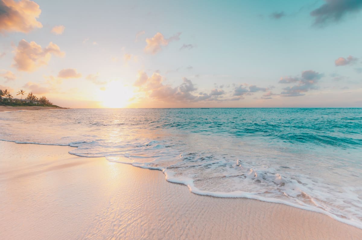
Mexican Caribbean Beaches in Quintana Roo State. Photo by Sean Oulashin / Unsplash

The marine origin of animal life awakens in the human being an accumulation of diverse sensations: man enjoys the sea and feels for it an irresistible attraction, a vehement curiosity, and enormous respect. There are many beaches located on other coasts of the world, but it would be difficult to find some that have all the characteristics that distinguish the Mexican Caribbean beaches located in the state of Quintana Roo.

Multiple reefs in this region have been the subject of documentaries and reports, particularly those that have shown the Palancar, near Cozumel. This reef, considered one of the largest, is a real underwater mountain that stretches for 10 km in the middle of calm transparent waters, allowing extraordinary visibility.

The reefs are formed on rocks where the dead parts of corals, invertebrate animals formed by a living part called a polyp, and a dead part, the polyp, are deposited, forming colonies that develop in shallow, warm (over 18°), and uncontaminated waters. The movements of collapse provoke the tamping of the rocky base, but due to the slowness of these movements, the corals continue their work of construction and increase the volume of the reef.

Coral reefs, which take 25 years to grow barely one meter, are ecosystems in which mollusks, crustaceans, fish, and an infinite number of microscopic algae live and serve as food for the corals. The lagoons of the coast of Quintana Roo, such as Bacalar, are another natural attraction, each one of them has its particular charm, but they all share a common denominator: their beauty.

Some are surrounded by low jungle and pastures; others are framed by abundant arboreal vegetation and tulares, in whose vicinity it is easy to observe animal species of the regional fauna such as wild boar, deer, wild turkeys, and pheasants, and there are also lagoons whose landscape is complemented by the characteristic medium jungle, rich in wild fauna.

To this diversity, we must add those that are protected as sites where tropical birds usually nest and reproduce, but that can be visited, and finally, those whose margins are pre-Hispanic and colonial architectural vestiges. Free diving is practiced in most of these lagoons.

There are beautiful beaches bordering the large hotel complexes of Cancun, but there are also beaches and coves along the coast, some quiet and secluded; Xel-Ha, Xcaret, Akumal, Chemuyil, Xcacel, and Paamul among others, which enhance their beauty with palm trees and vegetation typical of the area, combined with the waters of the Caribbean Sea.

Cancun

Cancun's well-earned fame for its singular beauty has old traditions, but it is since 1970 when the most important tourist complex of modern Mexico began to develop in this place, making Cancun -which in the Mayan language means "pot of vipers"- one of the most attractive vacation spots in the world.

It is known that the ancient inhabitants of Cancun developed on that island during the Postclassic period (1200-1519 A.D.) taking advantage of the marine resources for their exploitation, thus, the turtle and the shark not only provided them with meat, but also with shells to which they gave diverse uses; of teeth that they offered as offerings, of snails and shells that also served as food and as products of exchange.

The ability of the ancient inhabitants of Cancun to exploit fishing and trade salt allowed them to establish a regular exchange with other regions that provided them with jade, obsidian, gold, and copper, of which there is archaeological evidence in the area.

Although many travelers must have visited the island of Cancun in ancient times, the first known written report is due to the English captain Richard Owen, who during the first half of the 19th century, recorded his interest in the existence of fresh water wells, where fishermen were supplied with water.

John Stephens was the first to point out the existence of pre-Hispanic settlements that he located during his trip in 1865. He undoubtedly saw the temples of Punta Cancun, the coastal temple of Vamilum, the temple of San Miguel that is on the dunes, and those that exist in Punta Nizuc.

In 1878, Alicia and Augusto Le Plongeon described the ruins of Nizuc-Té that we know today under the name of "Del Rey" and William H. Holmes, upon entering the Nichupté Lagoon in 1895, described a site "with many stone buildings"' known today as the archaeological zone of San Miguelito.

Cancun's development is evident not only in the sumptuous hotel zone where the most famous international chains are represented but also in other types of services such as its avenues, among which the Paseo Kukulcan stands out, adorned with life-size archeological reproductions of sculptures belonging to various Mesoamerican cultures; its shopping areas, sports, and amusement centers and its museum.

Tulum

Zamá, which means "dawn" was probably the ancient name of the city we know today as Tulum, so named by the indigenous members of the troops that the government of General Porfirio Díaz sent to fight the uprising Maya at the beginning of this century, during the Caste War. Tulum means "fence" or "wall", alluding in this way to the great wall that defends it on three of its sides.

This pre-Hispanic city was the most important site on the eastern coast of the Caribbean Sea, between 1200 and 1400 A.D., since the boats loaded with products that the Mayan merchants transported from the coasts of Central America arrived at its beach.

In 1511 a Spanish expedition returning to Cuba from the Darien was shipwrecked off the Caribbean coast; 13 of its 15 survivors were sacrificed. Seven years later, the fleet commanded by Juan de Grijalva, marveled at the city of Tulum.

When in 1519 Hernán Cortés began the expedition that would culminate two years later with the conquest of Mexico-Tenochtitlán, he was informed in Cozumel that two Spaniards were living on the mainland; this motivated him to send in search of them. Gonzalo Guerrero and Jerónimo de Aguilar lived in Tulum and were the only ones who had not been sacrificed in 1511.

The first one had already been integrated into the Mayan life, he was cacique of a town, he had married and had children being thus the founder of the first mestizo family of the Peninsula of Yucatan, for that reason, he refused to reincorporate to the Spanish hosts. Jerónimo de Aguilar, being a religious man, lived in celibacy and heeded the call to join the expedition in which he played an outstanding role as interpreter.

The constructions contained in the walled enclosure composed of both religious and residential buildings, present a series of characteristics of this region: temples with walls leaning outward, small constructions as altars; reminiscences of Toltec elements, such as the use of snake-shaped columns, and simplified friezes, are some of the architectural elements perceptible in this site renowned for its extraordinary location.

Built on the edge of the cliff, the temple we know as El Castillo occupies the most outstanding site in the city and is its main structure.

Its present form is the result of several superimpositions, additions, and modifications made to the initial building throughout the years of its splendor. Located in front of El Castillo is Structure 16, better known as the Temple of the Frescoes, whose construction is one of the most interesting of the Postclassic period of the Mayan culture.

The main entrance is formed by four columns and its frontal decoration consists of a niche with the figure of the Descending God and a molding formed with stucco flowers. The corners of the temple are decorated with masks that probably represent the god Kukulcan.

Although the architecture of this temple is important, its exceptional value resides in the mural paintings that are conserved in its interior. With bluish-green color and on a black background were represented offerings where flowers, fruits, and corn cobs appear in abundance; the god Chaac, a deity related to the water, was represented with a series of goddesses among which Ix Chel stands out, who here appears as an old woman and who is known to personify the Moon.

The paintings of Tulum maintain very similar features to the Mayan codices, but at the same time, they show characteristics that are particular to the Mixtec codices, which confirms the late influence that this city received from other very distant cultural centers.

Another notable construction of the city is the Temple of the Descending God, located to the north of the Great Plaza. Its façade boasts the representation of that deity, possibly related to the Sun falling at sunset. In the interior of the temple are preserved remains of its mural painting where some deities, intertwined serpents, the planet Venus and other symbols related to water and agriculture were represented.

The House of Chultún, the House of Columns, the House of Halach Uinik, and other temples, shrines, tombs, and platforms also integrate the buildings inside the walled enclosure. But the remains of this city continue for several kilometers along the Caribbean Sea.

Cobá

Coba, which means "water agitated by the wind", became at the time of its splendor the most important city located northwest of the Yucatan Peninsula. During its heyday, it occupied an immense area, where there was room for the great ceremonial center, as well as an infinite number of housing units and the extensive cultivated fields that supplied it. At present, the archaeological zone, properly speaking, extends over 6 km.

Located between two great lakes, Cobá and Macanxoc, the great city was linked by an extensive network of sacbes or causeways, with distant and different places; to date, 42 sacbes have been located, among which stands out the one that links Cobá with Yaxuná, a site near the city of Chichen Itzá, in Yucatán. This immense causeway is a truly monumental work of engineering, measuring 100 km long, 9 m wide, and reaching elevations of up to 2.5 m in swampy terrain. Nearby, a road roller, split in two, 4 m long, 70 cm in diameter, and weighing 5 tons, was found.

Between 1500 and 700 B.C., it is known that Cobá was a self-sufficient and developing agricultural and fishing village. The visible architecture, as much the one created by the ruling caste, like the one belonging to the diverse socioeconomic strata of its population, has allowed the archaeologists to maintain that it is the product of the consolidation of the villages that existed regionally during the Pre-Classic period.

During the 4th to 10th centuries A.D., a process of regional economic stability increased the political power of the leaders, who chose privileged points due to the presence of lakes with year-round accessible water to concentrate individuals and resources. Thus, dispersed housing units, as they became closer to the center of the great city, responded to more complex architectural requirements to be integrated into the style of temples and palaces.

Cobá contains many stelae, whose calendrical dates range from its possible creation as a city in the year 600 A.D., to those that contain dates equivalent to the XV century in which it was eventually vacated. The archaeological zone of Cobá is divided by groups of constructions. The Coba Group is composed of a ball game, a roofed tunnel with the typical Mayan arch, and its main structure called "The Church", a pyramid 24 m high, composed of nine bodies in whose summit is part of the temple that finished it.

The Nohoch-Mul Group, called this way by structure No. 1 that also receives that name, is formed by a group of buildings among which they highlight: Structure 38, one of whose vaults covers an interior space of almost four meters; the Stela No. 20, the best conserved of those of Cobá that reports a date equivalent to November 30 of 780 d.C., and the famous Nohoch Mul, pyramidal base composed of seven bodies with rounded corners, topped by a temple that recalls the style of the temples of Tulum, and that reaches a height of 42 m.

The so-called Group "D" or Macanxoc, is located on the shores of the lake of the same name surrounded by low jungle; this architectural complex is composed of 8 stelae and nine altars, all beautifully carved; a large platform with stairs that ends in a temple preserved in its entirety and whose entrance opening is divided by a column with capital, which supports a lintel with remains of painting in which some hieroglyphs that have numerical value can be appreciated.

Structure III, to the side of the previous one, is composed of two rows of columns finished off by square capitals. To the center of this group is Stela No. 26 which maintains similar characteristics in interest and beauty to all those that have been located in Cobá.

Kohunlich

Due to its architectural style, a whole region located in the south of the states of Campeche and Quintana Roo has been given the name of a specific place. In this region the ceremonial centers: Becán, Chicanná, Xpuhil, Payán, and Kohunlich are the most outstanding of the so-called Río Bec style. The architecture of this region combines elements of the Guatemalan Petén, immediately to the south, and the Chenes style, located to the north.

Kohunlich began to be explored in 1972 and the data obtained by the archaeologists indicate that this site was occupied uninterruptedly from 300 B.C., until the XIII century A.D. This city has several structures, the most notable being the Temple of the Solar Gods and the so-called Plaza of the Stelae.

The first of them was raised in the V century A.D., on a natural elevation of the land, its stairway is flanked by eight extraordinary stucco masks, which personify the Sun and that originally were painted red; six of them are severely damaged, however, the remaining two are in perfect conditions.

The masks are different from each other and carry a complicated headdress that suggests a mythological being, they wear nose rings and all of them show dental mutilation in the shape of a "T", which is the representation of the hieroglyphic Ik, intimately related to the solar representations. In the eyes of the masks, the hieroglyph Chuen, associated with the sacred Mayan calendar of 260 days, can be seen sgraffitoed.

The Plaza de las Estelas, another important architectural complex in Kohunlich, receives this name from one of its buildings in whose stairway there are four remarkable monolithic stelae possibly carved in the XIII century A.D. and that must have fulfilled some religious function.

Kohunlich has more than 10 paved hectares, which indicates that the entire city must have had this type of finish, which was intended to collect rainwater and store it, due to the scarcity of the liquid in that area, which is still being archaeologically worked.

Isla Mujeres

In 1502 Christopher Columbus made his fourth voyage to the lands he had discovered in 1492; the armada under his command was anchored off the coast of Guanaja Island, when an enormous canoe occupied by indigenous people approached them, the natives pointed out that towards the west there were large extensions of densely populated land.

These natives, undoubtedly Mayan, thus referred to the Spaniards as the existence of the Yucatan Peninsula. Columbus was not interested in looking for those lands because his goals were different, however, Antón de Alaminos, who was on that voyage as a cabin boy, kept that valuable information in his memory.

In 1517, the Governor of Cuba, Diego Velázquez, ordered Captain Francisco Hernández de Córdoba to look for lands where he could capture natives destined for the diverse works that the growing colonization of the Greater Antilles demanded. For this purpose, a small fleet of three ships was put together, with Antón de Alaminos as a pilot, who steered it westward. 21 days after setting sail, Isla Mujeres was discovered on March 1, 1517.

The island, 7 km long and 1 km wide, owes its name to the large number of idols found upon disembarking. The vast majority of these figures were female, perhaps associated with a fertility cult, although they could also represent the goddess Ix Chel, associated with the moon and patron saint of weavers, whose temple and observatory, consisting of a small chamber, is located to the south of the island.

From Islas Mujeres, the surprised Spaniards were able to see the Yucatan coast, which had never before been found by Europeans. This discovery caused a great commotion in Cuba since it was a new land, where there was a high civilization and it was supposed that its inhabitants lived in great cities that contained undreamed-of riches.

Since its discovery, Isla Mujeres became a provisioning site for the ships that traveled through the Caribbean Sea, since it was mainly supplied with water, salt, and lime.

Today, Isla Mujeres is internationally renowned for its characteristic natural beauties, such as the beaches of "Cocoteros", "Lancheros", or the marine national park of El Garrafón. Free diving is practiced as a pleasant experience in all its surroundings and professional diving is reserved for the visit to the caves where it has been discovered that sharks usually spend long periods sleeping, which allowed Jacques Cousteau to film one of his most important documentaries.

Isla Mujeres has a population of approximately 23,000 inhabitants, which, due to its deep-rootedness, give its local festivities a more traditional flavor compared to those that take place in other tourist centers of the region; thus, its carnival, which usually takes place between February and March, enjoys great popularity due to its joy and colorfulness.

The international regatta "Amigos de Sol a Sol" that culminates there at the end of April, is celebrated with a series of festivities; and the religious festivities of "La Concepción" that take place from December 1st to 8th and the one dedicated to honoring the Virgin of Guadalupe on December 12th, are a reason for the islanders to show their traditional hospitality.

Contoy Island

With a length of 6.17 km and only 20 meters wide at its narrowest part, Contoy Island is a natural sanctuary, protected and regulated, where a great variety of marine birds live and nest.

Contoy is located one hour by boat from Isla Mujeres and was declared a National Wildlife Reserve in February 1961. More than 70 species of birds, among them the pink heron, spoonbill heron, white ibis, frigate birds, brown pelicans, sea swallows, and occasionally flamingos, live in Contoy, sharing it with white, hawksbill, loggerhead, and leatherback turtles; with striped iguanas, metallic iguanas and boas; and with an infinity of blue crabs, sea spiders, bayonets (200 million-year-old living fossil species) and hermit crabs.

The island has numerous lagoons: Norte, Pajarera Norte, Muerta, Pajarera Central, Pajarera del Sur, and Puerto Viejo which is the largest of them but because it lacks drinking water it was not inhabited by man, which allowed many wild species to take refuge in that place.

Today there is a biological station with a 15 meters high lookout tower from where you can observe the wildlife that has made it famous and the surveillance is in charge of the guards who permanently guard it as well as the scientists who carry out different types of studies. Visits during the day are welcome and to respect the wildlife, a small museum on local ecology has been built next to the Contoy pier.

Cozumel Island

As a result of the discoveries made in 1517 by Francisco Hernández de Córdoba, the governor of Cuba, Diego Velázquez, organized 1518 an expedition commanded by Juan de Grijalva. On this occasion, the four-ship armada included Pedro de Alvarado, Francisco de Montejo, Gil González de Avila, and Antón de Alaminos, who would be inscribed in the American history of the 16th century for their participation in the Conquest of Mexico. To this group of soldiers, we must add the name of Juan Díaz, who served as chaplain of that expedition and who, when celebrating the first mass on the recently discovered island, "greatly impressed the natives", as some historians affirm.

The Island of the Swallows or Cozumel was baptized by Grijalva with the name of Island of the Holy Cross, for having discovered it on May 3, the day in which this Christian symbol is celebrated, but this name, not having roots, disappeared soon after, leaving in force the name of Cozumel.

Cozumel is an island 40 km long and 16 km wide, which during pre-Hispanic times was an important religious site and a place of change from land trade routes to sea routes, particularly during the Late Classic period (600-800 A.D.). However, its occupation began in the Late Preclassic period (300 B.C.) and continued uninterruptedly until 1519, as demonstrated by different archaeological studies.

Cozumel was not an isolated site in the context of the Mayan culture but was linked by sea, through an intense commercial exchange through the channel that separates it geographically from Yucatan, with other important Mesoamerican cultures, as demonstrated by the archaeological remains discovered there. This island served as a stopover in 1519 to Hernán Cortés' armada for the conquest of Mexico and also as a base in 1527 for Francisco de Montejo in his first failed attempt to conquer Yucatán. During colonial times it was a refuge for the pirates' Drake and Laffitte, who caused so many problems for the Spanish Crown and contributed to the myth of the fabulous treasures buried there.

Today, the island of Cozumel enjoys international fame both for its tourist infrastructure, which began in the 1950s and is highly developed today, and for the natural attractions it offers visitors; Of these, it is worth mentioning the Chancanab lagoon with its unique inner reef, home to more than 60 varieties of tropical fish that can be easily observed from the shores, and also the botanical garden that contains rare specimens of tropical and subtropical species from both the continental massif and from different parts of the world.

This garden is among the most beautiful in the state of Quintana Roo. Many beaches and reefs offer visitors the possibility of enjoying the most varied aquatic sports, in which diving occupies a preferential place: San Juan, Maya, San Francisco, San Martin, and Chun Chacab beaches, among many others. As far as reefs are concerned: Paraíso Norte, Paraíso Sur, Chancanab, Yocab and Tunich are the most frequented.

For archaeology lovers, San Gervasio, located in the center of the north of the island, is the most important of the four sites that have been explored. In San Gervasio 6 groups of constructions of great interest have been located; of these, the first three have evidenced in one of their nine structures, very well preserved mural paintings, vaulted constructions, massive burials, platforms, residential units, altars and tombs that are well worth visiting.