The Dynamic Oceanography of the Gulf of California

The Gulf of California, a closed subtropical sea stretching 1,000 kilometers, is a hub of high primary productivity, shaped by wind-induced upwelling, tidal mixing, and thermohaline circulation. Amidst arid and mountainous terrains, its geography and dynamic oceanography support marine ecosystems.
The Dynamic Oceanography of the Gulf of California
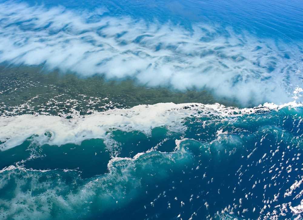
Tidal currents mix the deep blue waters of the Gulf of California, feeding the rich marine ecosystem below.

The Gulf of California, stretching roughly 1,000 kilometers in length, serves as a captivating illustration of the intricate interplay of oceanographic and climatic forces. A closed subtropical sea, it boasts high primary productivity, largely influenced by its unique geographical positioning and dynamic oceanography.

Oceanographic Forces at Play

Primarily, there are three mechanisms contributing to the fertilization of the Gulf:

Wind-induced upwelling: Winds play a pivotal role in stirring the ocean waters. In the Gulf of California, winter conditions from December to May cause upwelling on the east coast due to the northwesterly winds. In contrast, summer conditions from July to October lead to upwelling on the west coast, courtesy of the southeasterly winds. June and November serve as transitional periods, showcasing a seasonal inversion of wind patterns.

Tidal mixing: Tides, especially in the Grandes Islas Region, cause intense mixing of ocean currents. This process, akin to a constant upwelling, is of particular importance between the San Lorenzo and San Esteban islands. Here, strong vertical agitation reaches depths of over 500 meters, transporting cold, nutrient-rich waters to the surface, feeding marine life and supporting large populations of seabirds and marine mammals.

Thermohaline circulation: This is a result of the Gulf's unique geographic situation, nestled amidst arid and mountainous regions. As the Gulf loses moisture, it forms a juxtaposition of warm, high-salinity surface water and cool, nutrient-rich subsurface water.

A Deep Dive into Regions

The Gulf of California can be categorized into four distinct oceanographic regions: the Upper Gulf, the Gulf of California Great Islands Region, the Central Gulf, and the Southern Region.

In the Grandes Islas Region, tidal currents are influential due to the deep submarine canyons, where water circulates at high velocities with every tidal shift. These canyons plunge over a kilometer in depth. Meanwhile, the straits between the islands and the mainland and the passes connecting coastal lagoons with the Gulf witness strong tidal currents. These currents vary in speed based on lunar phases and prevailing winds.

The Whale Channel region is noteworthy for its winds, which can reach velocities of up to 25 m s-1. These winds play a crucial role in surface current activities, stirring the cold, nutrient-rich waters from the deep, resulting in heightened productivity. Notably, the Bay of Los Ángeles, a sub-region, exhibits unique tidal behavior. Studies, such as those by Amador et al., (1991), reveal limited tide variation within the Bay, attributed to its wide mouth and bathymetric distribution.

An aerial view of the Gulf of California, where wind, tide, and temperature converge.
An aerial view of the Gulf of California, where wind, tide, and temperature converge to support a thriving marine habitat.

The Seasons and Their Influence

Winter: Characterized by winds from the north and northwest. This season witnesses circulation entering through the northern channel between Punta La Gringa and Isla La Ventana, eventually flowing out through the southern channel.

Summer: Dominated by easterly and southeasterly winds. The water circulation essentially inverts from its winter pattern, entering through the southern channel and branching out across the bay.

Spring & Autumn: These transitional seasons see significant fluctuations in wind direction and intensity, leading to varied circulation patterns that are primarily influenced by westerly winds.

Further, illuminating the region's dynamics are the currents in the channel. These currents show a two-layer flow with opposite directions, indicative of thermohaline circulation. Moreover, energy transfer studies in the Gulf, especially in the Whale Channel region, reveal remarkable heat fluxes and evaporation rates.

In essence, the Gulf of California, with its blend of upwellings, tidal mixing, and thermohaline circulations, stands as a testament to nature's grand design. The interplay of these mechanisms not only supports vibrant marine ecosystems but also offers invaluable insights for researchers and environmentalists.

Sources: SEMARNAT and CONANP