Discovering the Little-Known Islands of Mexico's Pacific Coast

Unlike their counterparts in the Gulf of Mexico and the Caribbean Sea, the islands of the Mexican Pacific tend to be forgotten. Although they appear harsh at first glance, these regions are rich with potential for offbeat narratives and introspective landscapes.

Discovering the Little-Known Islands of Mexico's Pacific Coast
Panoramic view of the islands in the Mexican Pacific.

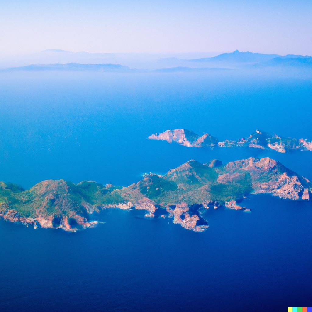
The islands of the Mexican Pacific are less well-known than those in the Gulf of Mexico and the Caribbean Sea, possibly because factors like distance from major cities, the temperature of the ocean, or the nature of the beaches prevent them from becoming popular tourist destinations. Despite their rough exteriors, they are rich environments for strange tales and contemplative landscapes.

Most Mexican islands are small and unknown, while some can be seen from the mainland shores by inhabitants or tourists. Unlike now, the islands were more important in past historical times because they were inhabited by indigenous people, while others were included on maps and itineraries since the Viceroyalty was an essential navigational marker.

Exploring the Hidden Histories and Legends of Baja California's Islands

The Cochimí Indians lived on Huamalguá Island (now called Cedros), which is west of Baja California. They took advantage of the fresh water and wildlife, using sea lion skins and deer meat for shelter and food. They also used pine wood to make canoes and cactus thorns and shells to make fishing tools. The Pericúes went extinct like the Cochimí, and with them went their history and knowledge of how they changed the landscape of islands like San José, Espiritu Santo, and Cerralvo in the southernmost part of the Gulf of California.

Also, in that gulf, which is also called the Sea of Cortés, the Comcaac or Seris saw Tiburón Island as the center of their ancestral land and San Esteban Island as a sacred space surrounded by a snake that must be appeased with ritual chants so that they can reach the shore without sinking and access its fruits and agaves.

In parts of the Pacific Ocean that don't live up to their names, many ships have had to fight against the currents to stay alive. With the help of new technology, shipwrecks from different times in history have been found near some islands in Baja California Sur, such as Magdalena and Santa Margarita. These wrecks are a gold mine for underwater archaeologists and treasure hunters. Some fishermen in the area might know about it or keep the mysteries that are hidden under the water a secret.

A common image of the islands is that of spaces of solitude. In many of them, there are lighthouses, which are beacons that help sailors, travelers, and fishermen find their way at night. The lighthouse keepers used to be able to see how slowly time went by, but now they are slowly being replaced by automated solar cell beacons.

On the west island of the San Benito archipelago (the Benitos Islands), off Baja California, a lighthouse operated until a few years ago, requiring daily manipulation and the placement of mercury to maneuver its mechanism. The inhabitants of Cedros, the nearest island, have transmitted for generations that the man in charge of the construction of the lighthouse, Enrique Dupre, nicknamed the Major, was famous for his cruelty with the workers: prisoners taken expressly to build the lighthouse and who were guarded by military men. The mistreatment received and the presence of Chepina (also known as the Raven), a cook by trade, generated tension and quarrels between the Major and the workers, who rebelled and murdered him, as recorded on the tombstone dated 1933.

It also happened in the Benitos Islands that a woman pregnant by a fisherman, either because of the hard crossing from Cedros or the difficult conditions in the place, gave birth prematurely to twins who died shortly after their birth. Their remains, as well as those of the Major, lie in that place, guarded by elephant seals and visited from time to time by divers and fishermen from Cedros Island.

In the Sea of Cortés, the islet of El Pardito, measuring 60 by 40 meters, has also been the scene of events that have given rise to stories, such as the one whose protagonist is Juan Cuevas. Like Robinson Crusoe, this character arrived at El Pardito looking for a safe shelter where to take refuge, far from the population centers, but also the gnats and located in an area rich in valuable marine species, such as sharks.

From the couple formed by Juan Cuevas and Paula Díaz, who arrived in the second decade of the twentieth century, four generations have emerged and have given continuity to the idea of an exclusively family place; some are still dedicated to fishing (which is traded in La Paz), while others have been musicians or have promoted tourism on a small scale.

Vegetation on one of the Mexican Pacific Islands.

The Islands of Isolation: Mexico's History of Confinement and Military Presence

As in Santa Elena (Atlantic Ocean), Devil's Island (French Guiana), or Alcatraz (California), islands were used as prisons and places to hold people who were not welcome. This was not a new idea in Mexico, where the Islas Marías was a federal penitentiary for 114 years. María Madre is the only one of the four islands that make up the archipelago that was used as a prison. María Magdalena, María Cleofas, and San Juanito were not used as prisons, which is why they have a better environment.

The fact that these islands were written about in books, newspapers, engravings, and even a "Mexican golden cinema" story with Pedro Infante as the main character made people think of them as places where people were forced to work. This image stayed in people's minds for decades, even though it was a unique prison where prisoners could bring their partners and children under 11 to live with them. Since the prison closed in March 2019, the "water walls" which were named by writer and social activist José Revueltas to describe the walls that kept people out of María Madre for years, will still be there, but now they are part of a cultural center.

On several islands in the Mexican Pacific, there are also military bases. Many countries' governments have made it clear that an island can be a strategic position that helps protect the country. Because it is so far away, people tend to forget about it or give it little importance. This happened during the Porfiriato and the Mexican Revolution in Clipperton, which was an open wound for French diplomacy.

Detachments of the Mexican Navy have been living on Guadalupe, Socorro, and Clarión, the last two islands in the Revillagigedo archipelago, for many years. For a while, sailors brought their families with them to Socorro Island. In 1994, when the Evermann volcano started erupting, new settlement rules were put in place. This made it impossible for civilians to live on the island and made it even harder for the people who had to work there. At the moment, these islands are encouraging specialized, low-impact diving tourism.

Mexico's Island Territories: A Complex Mix of Resource Extraction, Conservation, and Livelihoods

During the time of the viceroys, some resources were taken out of the islands. Because of the value of these resources, the islands were occupied at different times of the year. At the end of the 17th century, Jesuit missionaries from California found that the salt flats on El Carmen, an island in front of Loreto, were clean.

The El Carmen salt mine was still in use until the 1980s when its manual extraction methods couldn't keep up with more advanced industrialization methods like those of Guerrero Negro. Before this technology change, thousands of tons were taken to New Spain from El Carmen, San José, and Cerralvo.

San Marcos Island, which is also in the Sea of Cortez, is a less well-known example. In the southern part, there is a very pure gypsum mine, which is thought to be the second largest of its kind in the world. But the millions of tons of minerals were only shipped to the U.S. for most of the 20th century, and the reserves are about to run out, along with the workers' village that has been there for a century, though some locals are thinking about promoting sport fishing in the area.

In the case of fisheries, there are many examples, especially on the islands of Guadalupe, Cedros, and Natividad, which are off the west coast of Baja California. These islands have been home to divers and fishermen for decades, who work together in cooperatives to catch not only high-value species like abalone, lobster, and conch, but also sea cucumber, and sargassum. The people in these communities live on desert islands with a few patches of forest and in the ocean, where cold currents give them sustenance.

In Mexico's island territory, the idea of the island as a natural reserve with unique scenery is complicated and contradictory. Since 2016, all of the islands in the Mexican Pacific are thought to be part of a Natural Protected Area that has been declared by the government. But in some cases, the decrees don't apply to private islands, like San José, where goats aren't seen as exotic animals that need to be gotten rid of but are productive sustenance of food for families in the town of La Palma Sola.

The last idea is biological laboratories, which can be a study paradise for scientists, not just like Darwin's famous Galapagos Islands, but also as places that protect endemic species, like bird colonies that help ornithologists make progress in unpublished research. Rasa Island in the Gulf of California, where guano was taken, and Isabela, near Nayarit, are examples of places where biologists live with the things they study for long periods.

The Diversity of Mexico's 610 Named Pacific Islands: Histories, Characters, and Challenges

The panorama shows that each island in the Mexican Pacific can be an example of biological or human diversity and strategic space. Most of the reason there aren't more inhabited islands is that fresh water is hard to come by. Rarely it is found in enough quantity and quality to meet the needs of the population. In some cases, it has to be brought in from outside or made drinkable by plants that remove salt from seawater. Even though this is true, the number of people living on Mexican islands has been going down since 1990.

In the Mexican Pacific, there are 610 named islands, but only a small number of them have toponyms for their landforms, waterways, or coastlines. These names are often only known by the people who live there now or in the past. Behind place names like Melpómene Bay (Guadalupe), Tenis Creek (Cedros), Punta de los Bufelleros (San Marcos), and Grayson Creek (Socorro), there are stories of people who traveled to more or less remote places and left signs of their temporary, seasonal, or permanent occupation.

Each of the Mexican Pacific islands has its history, which is reflected in its activities, stories, people, and place names. These things also help draw a clearer picture of their territories. By the way, the name of the country, Mexico, which means "in the navel of the moon" or "in the center of the lake of the moon" comes from an island in the middle of a lake region. So, we need to think about how important it is to include the islands as part of our territory and find other interesting stories about geography to satisfy our curiosity.

Sources:

Martínez, Israel Baxin. “Historias Insulares En El Pacífico Mexicano | Israel Baxin Martínez.” Historias Insulares En El Pacífico Mexicano | Israel Baxin Martínez, June 2019, www.revistadelauniversidad.mx/articles/be5fad50-64ad-40b8-aad4-5e9ceb3a18ae/historias-insulares-en-el-pacifico-mexicano.