Drones: wildlife and habitat observation from the air

Although drones were originally developed and employed for military purposes, they are now used for many other tasks and objectives from the air.
Drones: wildlife and habitat observation from the air
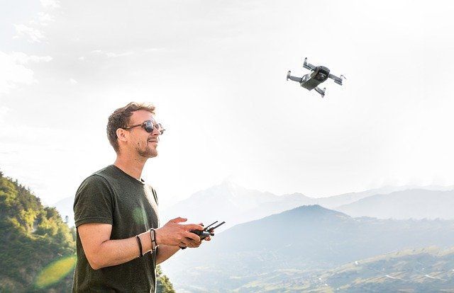
Drones: observing animals and environments from the air. Image by Lukas Bieri from Pixabay

Over the past 15 years, the use of quadcopters and unmanned aerial vehicles, also known as drones, for wildlife and habitat monitoring has been increasing. While drones were originally developed and employed for military purposes, they are now used for many other tasks and objectives.

In the work of conservation and management of wildlife species, constant monitoring is required to know the status and trend of populations, as well as the possible causes that could affect them such as changes in habitat due to deforestation and fragmentation, agriculture and livestock, the introduction of exotic species and poaching.

As part of these monitoring programs, various methods of field sampling are applied, including direct counting of animals on tour lines, capture-recapture in different types of traps, nets, and currently in camera traps; in addition, it has been traditional to use methods that involve tracking to count footprints, droppings, burrows and any other evidence of the presence of the species of interest. Other methods include tracking animals equipped with radio-telemetry, recording sounds and vocalizations, and even molecular markers for the identification of species and even individuals.

The application of any of these methods implies intense fieldwork which involves everything from the purchase of basic equipment, to the travel expenses of personnel in the sampling. Consequently, costs can be very variable but in general are high depending, among other factors, on the surface of the study area (NPA, AMU, or other), the species involved, the available personnel, and the method selected.

One of the methods commonly used for numerous species of the fauna around the world is direct counting of the animals from the air, either in light aircraft or helicopters. Even for some species, it is possible to identify them from aerial and satellite photos. For example, in the African savannas, the counting of antelopes, elephants, and other medium to large size species is done year after year in several National Parks such as the Serengeti. This methodology is used in many places around the world.

In Mexico, these methods have been applied to certain species such as white-tailed deer, mule deer, pronghorn, and bighorn sheep, mainly in the northern scrublands where it is possible to apply this technology. However, in all cases, the costs and risks of carrying out these flights are very high, both in economic terms and in human costs, where there have been unfortunate accidents with loss of human life while carrying out these tasks.

In addition, aerial sampling has served not only to monitor some species of fauna but also to obtain habitat information at a very fine resolution and detail, which allows in certain cases to document changes in the extent and quality of different types of habitat for fauna. This information, together with that obtained from other sources, allows the use of geographic information systems to evaluate the quality of the habitat.

What are drones being used for?

The use of quadcopters and unmanned aircraft, also known as drones, for monitoring wildlife and habitat has been increasing over the past 15 years. Though drones were originally developed and used for military purposes, they are now used for many other tasks and objectives such as high-resolution mapping; in agriculture, for fire control; for atmospheric condition assessment, also for construction impact assessment and urban planning, for surveillance, among others.

As technology improves and the costs of drones decrease, different organizations, institutions, and universities in the world have been implementing and developing laboratories and programs for the evaluation of this technology. Although drones are now in the "infancy" of their development, there are published data, including in major international scientific journals, about the advantages, limitations, and research and development needs for the application of this technology.

In the case of biological monitoring, drones are being used to observe and quantify from the air various species of fauna and flora, as well as to describe the landscape and human activities that impact them. For example, some of the species for which they are being applied are crocodiles, manatees, dolphins, whales, ducks, geese, kangaroos, elephants, rhinos, and others. This technology is even being applied to identify from the air nests and beds in the trees made by orangutans to spend the night; they have also been used to detect certain types of burrows or mounds made by various species of rodents.

Drones are also being applied to learn about and document some aspects of the habitat at a particularly interesting resolution and detail. With the advantage of doing this at different times of the year which has a lot of advantages over satellite and other information which can be expensive, or not at the resolution and in the seasons that are desired. Likewise, the drones are being used to know the foraging sites of the cattle which in many cases invade the habitat and compete with native species; and they are even being used to detect poaching.

What is a drone?

Essentially drones, also known as unmanned aerial vehicles, are aircraft that fly without a crew. Compared to motorized airplanes, drones are very small in size and weight, which vary depending on the different models. They fly at very low altitudes (less than 1 km), are controlled from the ground by one or two people using receiving equipment, although there are also variations that fly with an automatic pilot, and are usually equipped with equipment for taking panoramas and video which can be stored and/or transmitted for observation on the ground.

Of course, another important characteristic of the drones is that if they have any fault and fall to the ground, the only thing injured is the drone and equipment, but not the people. The best known by people, in general, are the helicopter-type drones among which those with four engines stand out. However, radio-controlled planes are also called drones. Both models have advantages and disadvantages depending on the objectives for which they want to be used. In biology, drones are being used for monitoring species, habitats, and other tasks.

How do drones work and how accessible are they?

Drones or unmanned aerial vehicles (UAVs) are aircraft that fly without a crew. A UAV is defined as a reusable unmanned vehicle, capable of maintaining a controlled and sustained level of flight, and powered by an engine. Drones are increasingly used in ecological research, in particular, to approach sensitive fauna in inaccessible areas or for rare animal species that are difficult to detect/observe by common methods.

Currently, there is a wide variety of commercial drones that provide the opportunity for researchers to improve the monitoring of wildlife populations. In particular, the Scout X4 model has the following characteristics that make it attractive to be used in the study of animals such as deer: according to the flight requirements, it can program the horizontal movements, through a mobile touch screen it can establish the takeoff point and destination.

The aircraft can return to the original point of departure, passing through the points marked on its trajectory. Real-time telemetry monitoring and iPad support with backup power compatible with tablets and others. Retractable landing gear allows good portability. High-performance engines, increased aircraft stability, and simplified maintenance. Battery capacity and flight time display up to 25 minutes at distances between 1.5 and 2 km.

What are the main limitations of drones?

Whether drones will replace or complement other methods of monitoring biodiversity is an issue that cannot yet be precisely answered. Among the main limitations is that the drones that are most suitable for use in monitoring are not cheap, although there are helicopter-type drones for commercial sale.

Moreover, the flight of drones requires training and equipment, which at the beginning is neither simple nor cheap. However, these same limitations existed at the time when, for example, 50 or more years ago radio telemetry began to be used to track animals; or less than 20 years ago photo-trapping began to be used to obtain information on species that were difficult to observe directly in the field.

In both cases, the technological improvement and the increasingly lower and accessible prices, have motivated a greater number of people and institutions to use these technologies to obtain biological information of the species of interest. Drones could follow the same story as shown by different laboratories where different models are developed, with better technology and cost reduction.

Certainly, similar to all methods, the use of drones is not a panacea nor is it intended to be useful for all species and habitat types. Their use will depend on the conditions to maximize the information that can be obtained in the flights, at costs that can be accessible in the different projects. In other words, at the moment the use of drones is not realistic as an everyday method, for example, for monitoring in extensive UMAs and large NPAs.

However, it should not be ruled out in the medium term that they will be used more frequently in these locations. Of course, the regularization and delimitation of drone flights is an important matter in order not to interfere with other activities or cause possible accidents. This is particularly true of commercial drones if they are used in urban areas or near restricted facilities. However, the application of drones in open and extensive areas where the species of fauna of interest live is less risky.

What is the future of drones?

According to the experience of several specialists in the use of this technology, in the next few years we will see, or expect, the following advances:

1) Increase in the duration of the flight due to the improvement in the power systems based on batteries and solar cells;

2) Considering the accelerated process of miniaturization in the electronic components, better sensors can be implemented in the drones, such as high-resolution video cameras and storage capacity, as well as other types of cameras such as thermal cameras to detect animals not easily observed directly;

3) Drones will be increasingly easier to operate;

4) The analysis of the information obtained with the drones will be analyzed more and more frequently, using automated equipment which will facilitate and reduce the time;

5) The drones will allow better mapping detailing real-time information; 6) The drones will be coupled with other technologies, such as radio-telemetry, to improve information capture.

By Salvador Mandujano and Alberto Rísquez Valdepeña, Source: Inecol