Discovering Chetumal Along the Bay and Hondo River

Explore the charming and unique city of Chetumal on a 130-kilometer journey from Oxtankah to La Union. Discover the historical and cultural richness, from its archaeological zone to its diverse border town. Don't miss out on the many attractions and sights this destination has to offer.
Discovering Chetumal Along the Bay and Hondo River
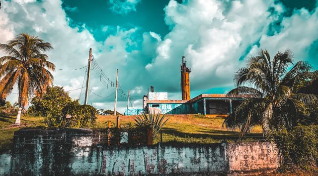
From Oxtankah to La Union: A 130-kilometer road trip through Chetumal, Mexico. Photo by Oscar Martinez on Unsplash

Chetumal, founded in 1898, is a young city located on the border between Mexico and Belize. Despite its youth, the city offers many interesting attractions and sights for travelers to explore. From the bay of Chetumal and the Hondo River to the cultural diversity of a border town, Chetumal is a destination worth visiting.

This guide will take you on a 130-kilometer (81 miles) journey from Oxtankah to La Union, highlighting notable stops along the way such as the archaeological zone of Oxtankah and the seafood restaurants of Calderitas. Join us as we embark on this journey through the charming and unique city of Chetumal.

This 130-kilometer route takes you from northeast to southwest, with all points along the way easily accessible by paved road. First, you'll travel from Oxtankah to Chetumal, following a road that runs along the bay of Chetumal. Then, you'll head from Chetumal to the town of Ucum on federal highway 186, towards Escárcega, Campeche.

In Ucum, make a south turn to take the third section of the route - an 86-kilometer road that runs parallel to the Hondo River, leading you to the border town of La Union. Getting around Chetumal is easy, with most of the city's main points located near the bay, except the museums.

Oxtankah

Our journey begins at the Oxtankah archaeological zone located 16 kilometers northeast of downtown Chetumal. This ancient city was built during the Classic period of the Mayan culture, between 300 and 600 A.D. It's located about 400 meters from the bay of Chetumal, which has led experts to believe that it may have been the great city of Chactemal mentioned in historical records.

The preserved buildings here were primarily residential, centered around two squares called the Bees and the Columns. These constructions were once adorned with large polychrome stucco masks, which have since disappeared. In 1531, the conquistador Alonso de Avila arrived here on the first Hispanic expedition.

Some researchers think it was built later, in the 1600s, but the remains of a chapel built on Mayan ruins are linked to this expedition. The archaeological zone is open to visitors daily from 8:00 a.m. to 5:00 p.m.

Chetumal

Chetumal is a city located in the bay of Chetumal, just a few meters from the mouth of the Hondo River. It was started by Navy Lieutenant Othón Pompeyo Blanco on May 5, 1898. At the time, it was called Payo Obispo. Initially, it served as a customs post and naval base to control the border and quell the Mayan rebellion in the Yucatan Peninsula. In 1936, the government gave it its current name.

Over the 20th century, the city grew and took on a new cultural, business, and political identity. Today, it is a city of over 170,000 inhabitants with all the services of a state capital. For travelers, Chetumal is the main gateway and base of operations in the southern part of the state, and it offers a variety of attractions.

According to some historians, it was here that the first mestizo Mexicans were born, the children of Zazil Ha, a Mayan princess from the area, and Gonzalo Guerrero, a Spaniard who had been shipwrecked in the Caribbean Sea in 1511.

Calderitas

Calderitas is a town that is six kilometers southwest of Oxtankah. It is in the Chetumal area. It is right by the bay and is famous for its great seafood restaurants. There is also an artificial beach built on sandbags in the area. From Calderitas, a 23-kilometer paved road runs north to the town of Raudales, in front of the Guerrero Lagoon. People from Chetumal go to Raudales to swim or fish in the clear water of the canals nearby.

Bahia Chetumal Boulevard
Bahia Chetumal Boulevard. photo: Boulevard Bahia Chetumal

Bahia Boulevard

Bahia Boulevard is a road that runs from the center of the city towards the northeast, always alongside the sea, as a coastal avenue. It is the main route to the city when arriving from Calderitas. The boulevard features a Sculpture Corridor, displaying 17 works of renowned Mexican artists such as José Luis Cuevas and Helen Escobedo.

As you enter the city, you'll come across the University of Quintana Roo, whose building was opened in 1993. At the intersection with Ignacio Comonfort Avenue, you'll find the charming Manatee Fountain, which commemorates the October 1996 decree that designated the bay of Chetumal as a sanctuary for these peaceful aquatic mammals.

Further southwest, the boulevard leads you to the city's lighthouse, which was erected in 1930. It then continues to the Legislative Palace, the seat of the state Congress. The palace features murals called "Law and Form, color and history of Quintana Roo" painted by Elio Carmichael, depicting the origins and history of the state. The Legislative Palace is open to visitors from Monday to Friday, from 9:00 AM to 10:00 PM.

Model of Payo Obispo

The Monumento al Pescador (Monument to the Fisherman) stands on the bay next to the Legislative Palace. It depicts a fisherman casting his nets for fish such as chihua, tarpon, shad, billfish, and mullet. Small, strange houses with wooden walls, slanted tin roofs, and big windows are on the other side of the palace. People say that these houses have an English colonial style and look like buildings from Belize, many of which were built in the first half of the 20th century.

One of these houses is in front of the palace, and it is where the famous Payo Obispo model is kept. This model was made by Luis Reinhardt McLiberty, and it is named after him. The model, which was assembled in the mid-1980s, depicts the city of Chetumal in the 1930s. Visitors can view the model from Tuesday to Saturday between 9:00 a.m. and 8:00 p.m., and on Sundays from 10:00 a.m. to 3:00 p.m. A tourism module is set up next to the model. It has brochures and maps of the city and the area.

Flag Esplanade

The Flag Esplanade is located two blocks west of the Payo Obispo Model. It has a big flagpole and a monument honoring the country's symbol. The monument is an obelisk with a clock on each of its four faces. At its base, two golden eagles stand on either side of a pedestal with a sculpture of the defense of the homeland on it. This art-deco-style complex, which was inaugurated in 1943, marks the center of the city.

In the area, a park with a kiosk can be found, and a short distance away is the Government Palace, the seat of the state's executive power. It was built between 1936 and 1955. Across from the palace, the dock is located on the waters of the bay of Chetumal. Every Saturday at 8:00 a.m., a boat leaves from the Chetumal dock for a three-hour trip along the Hondo River, where visitors can see birds, reptiles, land mammals, sunken ships, and, with luck, manatees.

Chetumal Cultural Center
Chetumal Cultural Center. Photo: Cultura

Renaissance Park

The Renaissance Park is right next to the Palace of Justice and two blocks west of the Government Palace. The park, which is more like a small square, features gardens and benches. In the center of the park stands a unique sculpture called Renaissance. The sculpture reminds people of what Hurricane Janet did to the city and how it was fixed. The hurricane devastated Chetumal on September 27, 1955, causing significant material damage and a high number of deaths and missing people—around 800 in a city of 8,000 inhabitants.

Chetumal City Museum

The Chetumal City Museum is located on the corner of Heroes Avenue and Héroes de Chapultepec, six blocks from the obelisk. The building, which was erected in 1989 during the government of President Lázaro Cárdenas, is a former Belisario Domínguez Socialist School and is adorned with unique bas-reliefs by Colombian artist Rómulo Rozo. The building serves as a Cultural Center of Fine Arts and includes the Minerva open-air theater, rooms for workshops and courses, and a bookstore.

It is also home to the Quintana Roo Institute of Culture and the Chetumal City Museum, which is a small but well-organized museum that shows how the state capital started and grew through photos, diagrams, maps, and other documents and artifacts from the past. The Morelos Hospital, which was designed by Rómulo Rozo and built between 1939 and 1940, is another great art deco building. It is on the corner of Juárez and Héroes de Chapultepec, which is west of the museum.

Museum of the Mayan Culture

The Mayan Culture Museum is at the intersection of Heroes Avenue and Mahatma Gandhi. The museum opened in 1993. It is part of the Quintana Roo Culture Institute and has a great display of Mayan culture thanks to Jorge Agostoni, who designed the museum. In the main hall of the museum, a sacred ceiba tree that grows from the underworld to the heavens shows how the Mayans saw the world.

The museum also has computers, TV screens, and interactive displays that show information about Mayan math, writing, keeping track of time, and astronomy. It also features models of different cities and buildings, some of which can be viewed under the glass floor of the hall. The museum also includes spaces for temporary exhibitions. It is a must-see for visitors, open Tuesday to Thursday and Sunday from 9:00 a.m. to 7:00 p.m. and Friday and Saturday from 9:00 a.m. to 8:00 p.m.

Subteniente López

About 8 kilometers west of downtown Chetumal, the highway reaches a traffic circle that features a monument to mestizaje. From there, the paved road branches off and heads south for about 3 kilometers to the border town of Subteniente López. There is a bridge over the Hondo River that has been in place for 40 years and can be crossed by foot or by car. On the other side, Belize welcomes visitors with a large Free Zone, an area filled with businesses that have little or no taxes on their merchandise.

Many Chetumal residents often go there to buy various goods, and also to play in one of the few casinos. When the North American Free Trade Agreement went into effect in 1994, Chetumal lost its duty-free status. This led to the start of the Belize Free Zone. To the right of the Free Zone, the road leads to Orange Walk, Corozal, and into Belize. Most travelers do not need a visa to enter Belize, but if they bring a car, they are required to buy insurance.

Laguna Milagros

Five kilometers west of the Subteniente Lopez town, on the same highway that leads out of Chetumal, lies the town of Huay Pix on the shore of Laguna Milagros. The town features several restaurants and a swimming area that also serves as a trailer park. Visitors can also rent kayaks or hire boat rides. The lagoon is similar to that of Bacalar, but smaller, and its waters are different shades of blue.

El Palmar

In Campeche, El Palmar is 6 kilometers west of Huay Pix. To get there, take the overpass and keep going on federal highway 186 toward Escárcega. Another 6 kilometers down this road is the town of Ucum, where you must turn left (south) to take the road parallel to the Hondo River.

From Ucum, it is 6 more kilometers to El Palmar, where you will find the El Manantial swimming facilities, an ejido recreational center located next to a spring, and an artificial pond. On its shore, there are benches and a restaurant serving beer, soft drinks, and fish. It is a simple but charming place, with beautiful trees and crystal-clear waters. In the same area, other rustic water bodies can also be found, which can become the exclusive domain of the traveler if visited during the week.

One of them is La Palma, located 2 kilometers southwest of El Palmar on the road to La Union; it is a solitary stream with very clean waters. On the same road, seventeen kilometers later is the town of Alvaro Obregón, where a place called El Balneario is located, with a beautiful creek boxed in by a couple of pools. One kilometer northeast of El Palmar is the town of Sacxán, on the banks of the Hondo River. The tourist boat from Chetumal goes there by this waterway. At the site, there is a small wooden tower with an excellent view of the river and the neighboring territory of Belize.

La Union

The road that starts in Ucum ends 86 kilometers later in the town of La Union, where visitors can cross into Belize by boat. The effort to reach this destination is worth it, especially if you visit the nearby cenote of the Golden Crocodile, located about 4 kilometers east of the town. The cenote offers a unique panoramic view of Mexico, as it is located at the foot of a small mountain range next to a stony wall dozens of meters high (which is the best place in the entire state for rappelling).

Its cobalt blue color contrasts with the green of the surrounding jungle and the gray tones of the mountain. If you want to swim, avoid doing it in the cenote, where crocodiles may be present. Instead, take a dip in the small, safer creek that carries water from the cenote to the Hondo River. The banks of the Hondo River offer many other places of exceptional beauty, but with more difficult access. To explore them better or to enjoy them through adventure sports, it is recommended to go to one of the local tourism companies.

The charming and unique city of Chetumal, Mexico.
The charming and unique city of Chetumal, Mexico. Photo: Biodiversidad

In conclusion, Chetumal, the capital of the state of Quintana Roo, Mexico, located on the border between Mexico and Belize, 0ffers many interesting attractions and sights for travelers to explore. From the bay of Chetumal and the Hondo River to the cultural diversity of a border town, Chetumal is a destination worth visiting.

This guide highlighted a 130-kilometer journey through the city, showcasing notable stops such as the archaeological zone of Oxtankah, the seafood restaurants of Calderitas, and the Sculpture Corridor on Bahia Boulevard. The city is easy to navigate and offers a variety of attractions, making it a great base of operations for exploring the southern part of the state.