How many canyons does Chihuahua have and where are they located?

Visiting the famous Chihuahua canyons? Discover the best tourist places to see and make the most of your vacation. These are the most popular attractions.
How many canyons does Chihuahua have and where are they located?
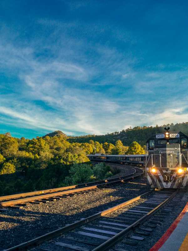
Things to visit in Chihuahua. El Chepe train. Photo by Alejandro Cartagena 🇲🇽🏳‍🌈 / Unsplash

The city of Chihuahua is the capital of the state of the same name, the largest in Mexico, and the site of one of the most important natural wonders of the world. The reason to visit the city is to get to know the famous canyons. If you love to travel to relax in breathtaking landscapes, Chihuahua is the ideal destination.

Urique Canyon

Depth 1,879 meters.

This is the deepest ravine in Chihuahua and Mexico. It originates at the junction of the Copper and Tararecua canyons. It is the best-known canyon in the sierra because it can be seen from the Divisadero station of the Chihuahua to Pacific Chepe Railroad, although many people confuse it with the Copper Canyon. Its most important viewpoints are among the pines at 2,400 meters above sea level; the Cerro del Gallego, Mesa de Arturo, and El Divisadero stand out. At its bottom runs the Urique River that flows into the Pacific through the State of Sinaloa.

Its name is due to the community of Urique, which is located at about 500 meters above sea level at the bottom of the ravine, on the banks of the river, surrounded by beautiful semi-tropical and warm vegetation. To get to El Divisadero or Posada Barrancas, you can arrive by road from Chihuahua, Chihuahua, Chih. in approximately 6 hours (304 kilometers). The most traditional way to get to this beautiful place is via the Chihuahua to the Pacific Railroad, either by taking the train in the city of Chihuahua or Los Mochis, Sin.

Another of the most spectacular viewpoints of the Copper Canyon is the Cerro del Gallego, to access it; you must get off the Chepe Railroad at Bahuichivo Station, and stay in the community of Cerocahui located 18 kilometers from the train station. In Cerocahui you will find all the tourist services you need such as hotels, cabins, restaurants, and guided tours that you can hire to visit the Cerro del Gallego or go down to the town of Urique located at the bottom of the Barranca.

There are no time restrictions at the viewpoints, so if you are a fan of photography you can wait for the best hours to get excellent impressions of the beautiful scenery. The descent to the canyons usually lasts two days, if you like camping it is an unbeatable opportunity to enjoy nature. And for those who like adventure tourism, there is the Urique River, which can be traveled in rafts, as long as you are a specialist in this sport. There are also horse rentals.

For the descents to the bottom of the ravines, good physical condition is required, as well as appropriate clothing for the season. To observe the ravine from the viewpoints, any season is good, although the summer and autumn months are especially recommended, due to the colorful colors of these seasons. To descend the ravine, winter or spring is recommended, because in summer it is very hot at the bottom.

Sinforosa Canyon

Depth 1,830 meters.

It is perhaps the most spectacular canyon in the sierra and the second deepest. Precisely for this reason, it is known as "The Queen of the Ravines". It is accessed from the town of Guachochi, 18 kilometers to the south, where the viewpoint of Cumbres de Sinforosa is located. At its bottom runs the Verde River, which joins the Urique River to form the Fuerte River, flowing into the Pacific. On its slopes, this ravine has important waterfalls such as Rosalinda and San Ignacio (both 100 meters), as well as other wonders. Its walking tour is one of the most important in the region.

One of the main activities is camping, hiking, etc., going down to the bottom of the ravine, and during this descent admiring the beautiful scenery. It is also impressive to observe the canyon from the viewpoints, and any season is good for this. You can also visit the town of Guachochi and buy various handicrafts, such as wooden violins, wool blankets, palm works, drums, arrows, etc.

Batopilas Canyon

Depth 1,800 meters.

This ravine stands out for its history, which revolves around mining and its most important center, the beautiful town of Batopilas, located at 450 meters above sea level, at the bottom of the ravine. It has imposing views from its viewpoint of La Bufa. At its bottom runs the Batopilas River, which is also part of the Fuerte watershed. Some of the most traditional Rarámuri communities are preserved in this canyon. It is accessed by road from Creel-Guachochi, in the town of Samachique is the turnoff to reach Batopilas, the pavement ends in Quirare and from there begins to descend into the ravine by a stretch of dirt road for about 3 hours.

Candameña Canyon

Depth 1,750 meters.

Candameña Canyon is one of the seven canyons that make up the complex called Barrancas del Cobre. It is located in the Cascada de Basaseachi National Park, 276 kilometers west of the Chihuahua State capital, four hours away on Highway 16 that goes to Ciudad Cuauhtémoc, La Junta, San Pedro, Tomochi and Basaseachi. This canyon combines spectacular scenery and beauty. It stands out because it has the two highest waterfalls in Mexico: Piedra Volada (453 meters) and Baseaseachi (246 meters). This is why it is known as "La Barranca de las Cascadas" (the ravine of waterfalls).

It also contains the Peña del Gigante, which presents the highest vertical stone wall in Mexico known so far, it is 885 meters high. At its bottom runs the Mayo River. Its main viewpoints are Baseaseachi, Huajumar, Piedra Volada, and El Gigante. This canyon forms the Baseaseachi Waterfall National Park, where a great wealth of flora and fauna is preserved.

Chínipas Canyon

Depth 1,600 meters.

It is perhaps the least known due to its remoteness. At its bottom runs the river of the same name, a tributary of the Fuerte. At the bottom of this ravine is the mission town of Chínipas, the oldest in the Sierra and one of the best-preserved.

Oteros Canyon

Depth 1,520 meters.

Between the old mining towns of Maguarichi and Uruachi is the Oteros Canyon, accessible from both towns by dirt roads. It can also be reached via El Divisadero and San Rafael. Among other wonders of this canyon is the Rocoroybo waterfall with its three waterfalls.

Copper Canyon

Depth 1,300 meters.

This name is known generically to the whole system of ravines. This is because when the Chihuahua to the Pacific railroad station was opened, the Urique Ravine, which can be seen very well from there, was confused with the Copper Ravine. The truth is that the Copper Canyon is little known. Its access is through the community of El Tejabán, which is located 50 kilometers from Creel, in the upper part of the Urique River. The Urique ravine begins at the junction between the Copper Canyon and Tararecua. It is possible to see the initial part of this ravine at kilometer 58 of the Creel-Guachochi highway. From its name to some old mines that there are in its bottom in which it exploited the copper.