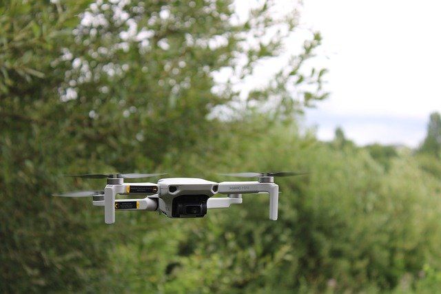
What is a drone? Remote control technology
Drones are technically called "Unmanned Aerial Vehicles" (UAVs). These are small unmanned aerial vehicles with a wide range of sizes, shapes, and functions, controlled by ground systems (remote control).

They are probably one of the most advanced technologies in the field of robotics, aeronautics, and electronics. The technical name for drones is "Unmanned Aerial Vehicles" (UAVs). They are small unmanned aerial vehicles with a wide range of sizes, shapes, and functions, controlled by ground systems (remote control).
The word drone is an adaptation to Spanish of "drone", its meaning alludes to a bumblebee or drone, since the prototypes manufactured were small aircraft intended to reproduce the ease of flight of the bumblebee to increase versatility and the depth of North American aircraft. The first drone project, an unmanned aircraft, was carried out by Archibald Low in 1916, since then several prototypes have been made.
Drones have been developed and put into service only a few years ago, they can be used in countless tasks that humans cannot or do not want to perform, or are simply too dangerous, such as exploration or toxic waste cleanup, and of course, for war purposes.
Drone Engineering
Drones are made of lightweight composite materials to reduce weight and increase maneuverability. In addition, the strength of the composite material allows cruising at very high altitudes. They are generally equipped with Global Positioning Systems (GPS), the military type with state-of-the-art infrared cameras, laser or guided missiles, and other top-secret systems. That is why a drone consists of the robot itself and the control system, which can be operated from the ground or via satellite, simply or with precision flight programs. Drones can fly at extremely high altitudes to avoid detection.
Drones with these characteristics are manufactured for thousands of dollars, since they are mostly used in military services, due to the high precision with which they are handled. With them, important tasks have been carried out in the prevention of terrorist attacks, location of bombs, and dangerous devices. The most popular drones of this type are the FFAA, the MQ-9 Reaper, and the Predator MQ-1B, which played a key role in gathering intelligence on the whereabouts of Osama Bin Laden. These models are shaped like airplanes and have been developed by military powers such as England, Israel, Norway, and above all the United States.
Military drones are part of the present and future of the military of developed countries. Their use is being questioned today by the United Nations (UN), the organization is very concerned that this type of system may be violating human rights and other laws. Such is the concern that in the previous meeting countries such as Ireland, Holland, Spain, France, Austria, Croatia, Mexico, and Sierra Leone among others, expressly requested that some type of regulation or control be established so that their use complies with the legislation, although its real purpose is precisely to prevent this type of systems from being used.
Applications and uses of drones
Drones have great potential in very diverse areas since they can move quickly over irregular or uneven terrain and overcome any type of obstacle, offering bird's eye view images and other types of information collected by different sensors. Today's drones have been manufactured in various forms, depending on their application, the most common ones simulating miniature helicopters.
One or more helicopter-type drones can search for missing persons in open or inaccessible places such as mountainous or snowy areas. The small size of these drones allows them to be always available in mountain stations, reducing search time considerably. The low cost of these drones compared to the cost of a traditional helicopter makes them ideal for this task (a traditional helicopter is at least 30 to 60 times more expensive, and involves risk of human lives, high fuel consumption, etc.).
Drones are used for the control, handling, and cleaning of noxious or contaminating materials. In the case of nuclear power plant disasters such as the one that occurred in Fukushima, Japan, and the radioactive materials released into the air must be cleaned up, drones could fulfill this responsibility without compromising human life in any way. Unfortunately, at the time of the disaster in Japan, this technology was not yet well developed, but drones such as the T-Hawk have been used to take pictures of the state of the reactors.
The use of this T-Hawk was crucial to obtain a detailed view of the state of the inside of the reactor and to obtain photographs and other data with which to estimate the damage produced and thus develop a plan for cleanup and containment of future leaks. It should be noted that all these reports could not have been achieved in any other way, since human beings can't survive this level of radiation.
However, not all the uses that can be given to a drone have to do with dangerous or industrial operations, since recently simpler models have been introduced to the market, designed to be marketed in areas more linked to recreation and leisure, such as photography, video, package delivery or augmented reality games.
In the field of video and photography, drones have begun to be used to mount cameras to take aerial photographs of weddings and other social or sporting events, such as those used in the 2014 World Cup, based in Brazil.
Other drone applications
Environment: Elaboration of light pollution maps and monitoring the efficiency of eco-energy measures; control and monitoring of industrial accidents with toxic spills in aquatic and terrestrial environments; control of industrial waste deposit and storage areas and their treatment.
Agriculture: Control and monitoring of crop condition utilizing multispectral images, control of irrigation efficiency. Counting and monitoring of subsidized agricultural production (e.g. number of trees).
Livestock: Monitoring and grazing of herds and livestock, using cameras mounted on drones.
Forestry: Constant supervision, during high-risk hours, of a forested area, looking for active points or fire outbreaks.
Geology: Preparation of sedimentological, mineralogical, and geophysical geological maps, control and monitoring of mining operations and their environmental impact: earthworks, aggregate production, metallic waste, settling ponds, etc. Determination and control at centimeter scale of areas with associated geological risks or characterization of areas at risk of avalanches using multispectral images to determine snow moisture, thermal cameras to determine its temperature, and stereoscopic techniques to determine thicknesses.
Construction and inspections: Inspection of construction sites from the air. Estimation of the visual impact of large construction sites.
Crowd control and analysis: Demonstrations, concerts, etc.
Exploration of difficult access sites: Caves, cliffs, etc.
Mobility and Traffic: Recording and monitoring of the traffic situation.
Advantages of using drones
General price reduction, especially compared to piloted alternatives.
Improved performance: greater stability (allowing for better photographs) without sacrificing dynamism (which is not the case with zeppelins) and the possibility of flying at low speeds and close to the ground or obstacles.
Simplification of the process.
Automation of the process when it is necessary to photograph a larger area.
Obtaining 3D maps of terrain.
Reduction of work time.
Reduction of human resources required: One person can do the job.